A suite of technical surveys and assessment work has been carried out to inform the proposed scheme.
A summary of the key technical work is set out below:
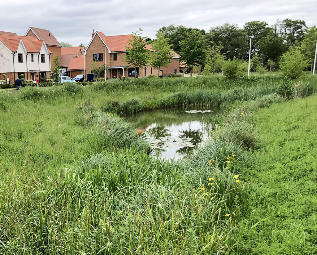
The proposed site falls from north to south. There are multiple ditch networks located around the site area. It is proposed that one of the existing ditch networks located within the site will be redirected and conveyed through a proposed swale before connecting to the ditch along the southern boundary of the site. Surface water flows generated by the site will be conveyed to five attenuation basins across the site. The first attenuation basin proposed in the northwest corner of the site will outfall to a ditch located along Stow Road. The three attenuation basins located along the southern edge of the site will outfall into the existing ditch along the southern boundary.
The fifth attenuation basin located in the southeast corner of the site will outfall into the ditch within the eastern central part of the site which in turn connects into the southern boundary ditch. Discharge rates into the ditch networks have been restricted to the QBAR Greenfield Rate of 10.2l/s.
A total storage volume of 5,068.93m3 will be required within the attenuation basins to accommodate for all events up to and including the 1 in 100-year plus 40% climate change event. Suitable treatment of surface water flows will be provided for in accordance with the relevant guidance.
We are aware through the public consultation already undertaken that the surrounding areas are at times subject to surface water run-off and therefore the proposed drainage solutions have been carefully considered to enable the existing situation to be improved as a result of the development.
Foul drainage from the site will discharge into the existing Anglian Water foul drainage network located within Kimbolton to the south of the site. In line with the requirements of the Water Industry Act, Anglian Water will be required to ensure suitable capacity is made available.
The site does not contain any designated heritage assets (for example listed buildings or scheduled monuments) and is not located within the boundary of a Conservation Area. The wider surrounding area contains a number of designated assets, for example the Grade II* listed Warren House, the Grade I listed Kimbolton School and the Conservation Area of Kimbolton which also contains the Grade I listed Church of St. Andrew. The proposed Scheme has the potential to impact upon the significance of these assets through changes to elements of their setting, for example by appearing in views from or between the assets and changing the character of such views.
The presence of these assets and the sensitivity of this location with regards to heritage has been a primary consideration from the very inception of this project and has helped to guide and shape the Illustrative Masterplan. As a result of the heritage sensitivities of the Site and surrounds, built form is located on the lower parts of the site so as to ensure that the existing inter-visibility between and views of assets are retained. Along the eastern edge of the site, a generous buffer of landscaping is provided and the quantum of housing kept lower in order to ensure that there is no adverse impact on the views of Kimbolton School or on the journey along footpaths leading to and from this area and past the site.
Furthermore, additional and retained planting will soften the development on the lower parts of the site. Importantly, the ‘higher’, more elevated northeastern part of the site has been retained as an area of more open space with a preservation of agricultural character to respond to the historical character of the area.
The settlement of Kimbolton is mostly located in the valley floor along the River Kym before land rises sharply to the south west and north east where it is quite open with extensive cross valley views in all directions.
Early on in the design development, the topography of the site has been an important consideration with the site and existing settlement being visible from a number of viewpoints, particularly those from the public rights of way within and around the site.
In response, development is proposed on the lower parts of the site where heights of buildings have been reduced as the land rises. Beyond the built form is proposed an open textured landscape that creates a framework that maintains outward views across the settlement and landscape, as well as reducing the scale of the agricultural parcels while still allowing for the creation of meadow/species rich grassland or areas of open scrub to enhance biodiversity.
The majority of the vegetation on the site, largely comprising hedgerows and a small copse around parts of the site boundary and field definition, will be retained except for access. New planting, including hedgerows, trees and small blocks of woodland planting will be provided to complement the existing structure and retain and enhance the attractive open character. New hedgerows will reflect the historic field pattern where appropriate. Street trees will further enhance the public realm and aid legibility of the development.
A thorough appraisal of the existing conditions of the local transport network, and the impacts a development such as this could create have been undertaken.
The site benefits from being within reasonable walking and cycling distance of a range of services and amenities in Kimbolton including bus services to Bedford, Huntingdon and St Neots, a primary school, convenience store and public house.
A newly formed site access is proposed from Stow Road to accommodate vehicles, pedestrians and cyclists. A second access for pedestrians and cyclists, that could also serve as an emergency access, will also be provided from Stow Road. The design of the site accesses will be prepared in accordance with all relevant national and local design guidance, as well as being subject to a Road Safety Audit. A further pedestrian access is provided along the southern boundary of the site via the existing PROW network providing access to Newtown.
Formal pre-application advice has been sought from the local highways authority in order to mitigate any potential impacts where necessary.
The outline planning application will be accompanied by a Transport Statement which will, amongst other things, consider the impacts of the proposals upon the operation of off-site junctions. This will help to understand whether improvements are needed to the local highway network to address impacts of the proposed developments.
Ashberry Strategic Land has undertaken surveys on the site to establish its baseline ecology value and in order to shape the proposals. The main features of ecology interest on-site are existing field hedges and trees given the farmed nature of the site.
The masterplanning exercise has been informed by the principle of retaining existing trees and hedgerows wherever possible. Only a limited amount of hedgerow and tree loss will occur to allow for internal access and new tree and other planting will occur throughout the site.
As part of the ecology work, detailed surveys have been carried out as part of formulating the development proposals and will be submitted alongside the planning application. The development will also include mitigation and enhancement measures to provide a benefit to those species which may be found locally, which will include bat and bird nesting boxes, hedgehog houses, and wildflower planting. As a result of these measures, and the extensive diverse planting across the site, the development will deliver at least a 10% Biodiversity Net Gain on-site enhancements, in line with national policy. This will ensure a significant improvement in the biodiversity over and above its existing condition.